The December solstice for 2017 begins on Dec. 21st at 16:28 UT (11:28 am EST). It is called the winter solstice for the Northern Hemisphere and the summer solstice for the Southern Hemisphere.
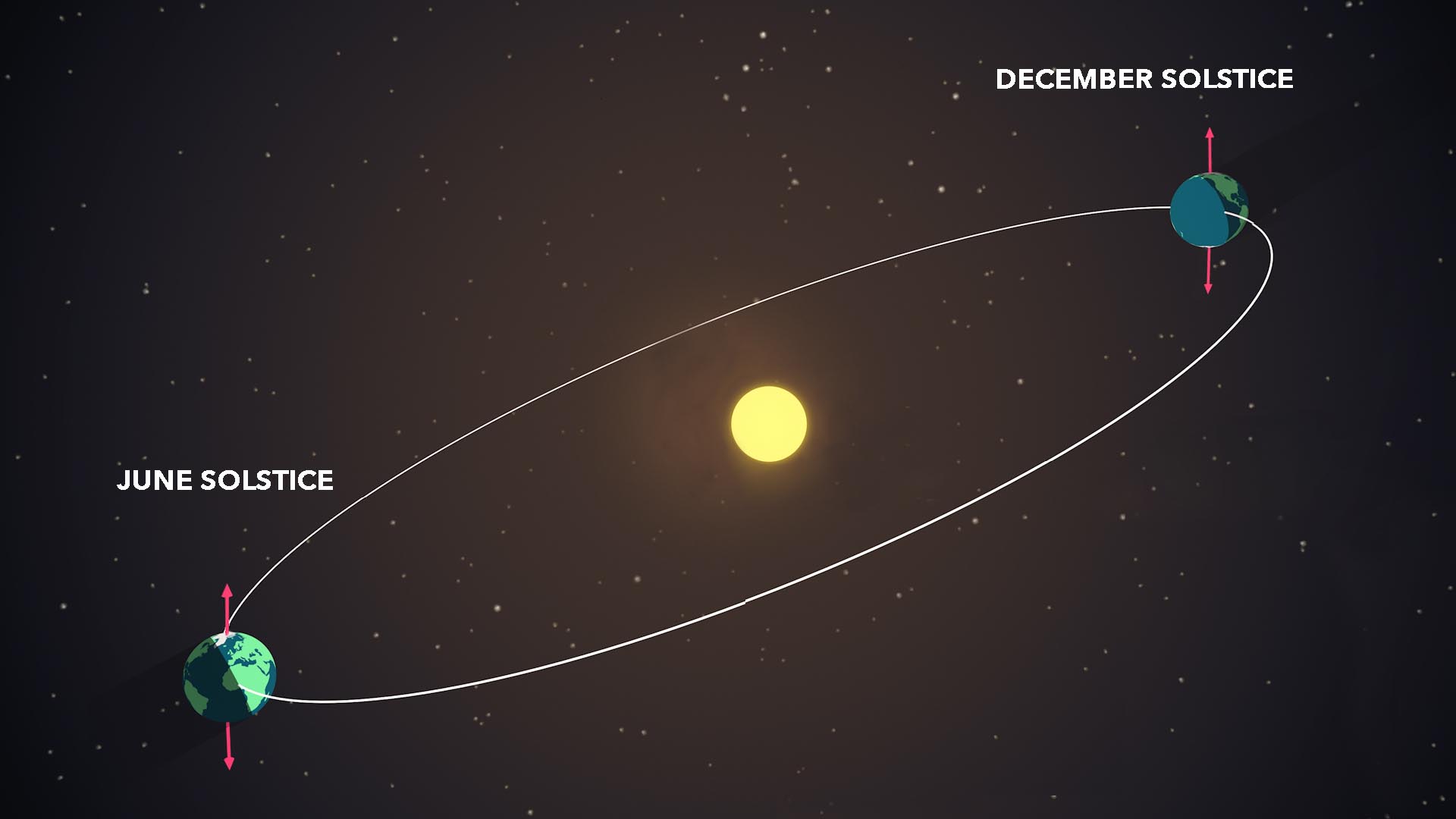
During the solstices, Earth reaches a point where its tilt is at the greatest angle to the plane of its orbit, causing one hemisphere to receive more daylight than the other. (NASA/Genna Duberstein)
But what is the solstice exactly?
There are two solstices in a year, the June solstice (usually June 21) and the December solstice (usually December 21). On the June solstice the sun reaches its highest point in the sky for an observer at the North Pole. On the December solstice, the sun reaches its highest point in the sky for an observer at the South Pole. Solstices also mark the change from fall to winter or spring to summer.
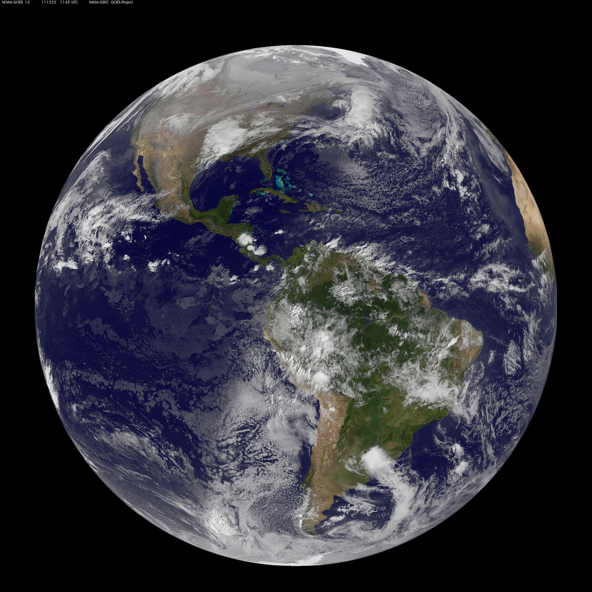
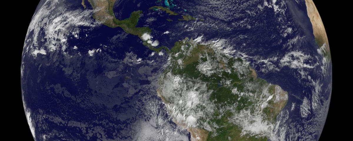
Image acquired December 22, 2011 NOAA’s GOES-13 satellite captured this image of Earth on the first day of the winter solstice, December 22, 2011 at 11:45 UTC. The GOES-13 cloud images are overlaid on a true-color NASA/MODIS map by the NASA/NOAA GOES Project at NASA’s Goddard Space Flight Center in Greenbelt, Md. Credit: NOAA/NASA GOES Project NASA image use policy. NASA Goddard Space Flight Center enables NASA’s mission through four scientific endeavors: Earth Science, Heliophysics, Solar System Exploration, and Astrophysics. Goddard plays a leading role in NASA’s accomplishments by contributing compelling scientific knowledge to advance the Agency’s mission. Follow NASA on Twitter Like us on Facebook Find us on Instagram
The solstices happen because of the tilt of Earth’s axis of rotation with respect to its orbital path around the sun. The axis of rotation is an imaginary line drawn straight through Earth connecting the North Pole to the South Pole. This line is tilted 23.5° from Earth’s orbital path around the Sun. This means that the sun’s light does not hit the Earth evenly at a particular latitude above and below the equator. This tilt is the cause of Earth’s seasons. (The equator is an imaginary line drawn right around Earth’s middle, like a belt. It divides Earth into the Northern and the Southern Hemispheres. The imaginary lines around Earth that are parallel to the Equator are called lines of latitude. They are numbered from 0° to 90°. The one at 0° is the equator itself. The higher the number, the farther north (if it’s a + number) or south (if it’s a − number). )
Because of Earth’s tilt is 23.5° the latitudes of +23.5° and −23.5° are special and have special names. The one in the Northern Hemisphere, +23.5° latitude, is called the Tropic of Cancer. The one in the Southern Hemisphere, − 23.5° latitude, is called the Tropic of Capricorn.
These are the latitudes where the Sun is directly overhead at noon once a year. In the Northern hemisphere, on the Tropic of Cancer, that is the June Solstice. In the Southern Hemisphere, on the Tropic of Capricorn, that is the December Solstice. These solstice days are the days with the most (for Summer) or fewest (for Winter) hours of sunlight during the whole year.
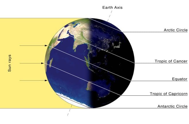
The Sun is directly overhead at “high-noon” on December Solstice at the latitude called the Tropic of Capricorn.
Every six months, Jan Koeman of Zierikzee, the Netherlands, uses a beer-can solargraph to record the progress of the sun in the sky from solstice to solstice. Here is a collection of solargraph images compiled by Jan from his site.

Compilation Solargraphs winter solstice 2013 participants Philippus Lansbergen Observatory, Middelburg, the Netherlands credit: Jan Koeman (http://bit.ly/1sX98as)
credit: NASA/Jan Koeman


